Understanding the Landscape Before You Swing a Coil
Successful metal detecting in the UK is rarely about luck. The detectorists who consistently pull interesting finds from British soil are not simply covering more ground than everyone else — they are reading the land itself. Every field has a story written into its topography, its soil composition, its hedgerows, and its relationship to the settlements and roads that have come and gone over centuries. Learning to interpret those clues before you even switch on your detector is arguably the most valuable skill you can develop.
This guide covers the practical methods, historical research tools, and on-the-ground observation techniques that will help you approach any UK field with a far greater chance of finding something significant. Whether you are working a freshly ploughed arable field in Suffolk, a permanent pasture in the Welsh Marches, or a hillside in Yorkshire, the principles remain the same: the ground holds information, and your job is to read it.
Starting With Historical Research
Before you set foot on a field, you should spend time at a desk. Historical research transforms random searching into targeted investigation, and the UK is exceptionally well served by freely available resources that can reveal centuries of land use, settlement patterns, and human activity.
Ordnance Survey Historical Maps
The Ordnance Survey has been mapping Britain since the late eighteenth century, and old editions of OS maps are among the most useful tools a detectorist has. The National Library of Scotland hosts a superb free online map viewer that overlays historical OS editions — including the highly detailed 25-inch series from the 1880s and 1890s — directly against modern satellite imagery. This allows you to identify features that no longer exist above ground but almost certainly left evidence beneath it.
Look specifically for:
- Former buildings, farmsteads, or cottages that have since been demolished
- Old trackways, drove roads, and footpaths that crossed the field
- Ponds, wells, and watercourses that have been filled in or diverted
- Former field boundaries and hedgerows that have been removed during twentieth-century agricultural consolidation
- Any notation indicating a former use such as a smithy, mill, or marketplace
Each of these features represents a point where human activity was concentrated. Coins, buckles, buttons, and personal items tend to cluster around places where people regularly gathered, worked, or passed through.
Tithe Maps and Estate Records
Tithe maps, produced predominantly in the 1830s and 1840s following the Tithe Commutation Act 1836, provide extraordinary detail about field boundaries, ownership, and land use at a parish level. They are held at county record offices and many are now digitised through The National Archives or local archive services. The accompanying apportionments list the name of every field, which itself can be historically significant — field names such as “Gold Hill,” “Pottery Field,” or “Chapel Ground” often reflect former uses or finds made by previous generations of farmers.
Estate records, manor court rolls, and enclosure awards held at county archives can push your research even further back. Many county record offices offer free or low-cost access, and the staff are generally very willing to assist researchers.
The Portable Antiquities Scheme Database
The Portable Antiquities Scheme (PAS), administered through the British Museum and Amgueddfa Cymru – Museum Wales, maintains a publicly searchable database of over 1.6 million recorded finds from England and Wales. This is an invaluable resource for understanding what has already been found in a given area, which periods are represented, and where activity clusters might exist.
Searching the PAS database by county, parish, or find type can reveal that a particular area has a strong Roman or medieval signal, or that a specific field has produced multiple coins of a particular period. This does not mean the field is exhausted — it often means the opposite. A field with a documented history of Roman finds likely sits on or near a route, settlement, or activity zone that extends well beyond what has already been recorded.
Understanding Soil and Geology
The physical composition of the soil has a direct bearing on both the survival of finds and your detector’s performance. Sandy, free-draining soils tend to preserve metal objects well and cause fewer mineralisation problems for most detectors. Heavy clay soils can cause significant signal interference and also corrode finds more aggressively over time. Chalk downland — particularly common across southern England in counties such as Wiltshire, Hampshire, and Kent — often yields well-preserved objects because of its alkaline, dry character.
The British Geological Survey provides free online mapping of soil types and underlying geology. Cross-referencing this with your historical research allows you to refine your search strategy considerably. For instance, knowing that a hillside field sits on a gravel terrace above a river floodplain tells you that it would have been a logical place for prehistoric or early historic settlement — elevated, well-drained, and close to fresh water.
Reading Soil Colour in the Field
Once you are on site, pay close attention to variations in soil colour when the field has been freshly ploughed or harrowed. Darker patches within a lighter soil matrix can indicate the presence of decayed organic material — the remnants of former structures, middens, or buried features. These darker areas, sometimes visible as crop marks from elevated positions during dry summers, are precisely the kind of feature that concentrates finds.
Conversely, a spread of lighter, chalky subsoil within a darker topsoil might indicate where a building once stood, its rubble gradually incorporated into the plough layer over centuries. Both types of discolouration are worth investigating systematically.
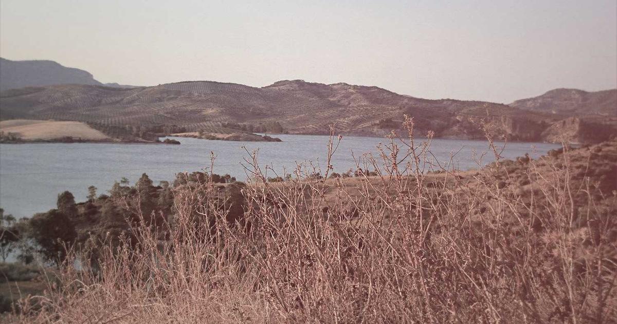
Reading Topography and Field Layout
The shape of the land is one of the most telling indicators of past human activity. People throughout history made rational decisions about where to build, farm, travel, and trade, and those decisions were governed by the same topographical logic that still shapes how we use land today.
High Ground and Prominent Points
Hilltops, spurs, and ridgelines were consistently favoured for settlement, religious activity, and communication throughout prehistory and into the medieval period. In detecting terms, a gentle rise within an otherwise flat field, or a field that sits on a promontory between two valleys, deserves particular attention. These are locations where Bronze Age activity, Iron Age occupation, or Roman-period use might be concentrated.
Do not, however, assume that the very top of a hill is always the most productive spot. The flanks of hills, particularly those offering shelter from prevailing winds and proximity to a spring or stream, were often more heavily occupied than the exposed summits.
River Terraces, Fords, and Crossing Points
River crossings have always been focal points for human movement, and the banks and terraces adjacent to ancient fords are among the most reliably productive locations in British metal detecting. Coins and personal items dropped or lost during river crossings accumulate over centuries, and the approach routes to fords — often preserved as drove roads or ancient trackways — can extend productive ground for considerable distances.
Old maps and estate records frequently mark former ford locations, and the persistence of place names containing elements such as “ford,” “wade,” or “passage” in local addresses or field names is a reliable indicator worth investigating.
Former Hedgerows and Field Boundaries
The widespread removal of hedgerows during the agricultural intensification of the 1950s through 1980s has left many British fields considerably larger than their historical predecessors. However, the lines of former boundaries are often still detectable — both in the soil and through careful reading of old maps — and they represent an important target for the detectorist.
For centuries, hedgerows were the edges of agricultural life. Workers rested against them, coins fell from pockets during the lunch break, and the boundary itself was a place of repeated human presence. Running a grid search along the line of a former hedgerow, as identified on a nineteenth-century OS map, frequently produces results disproportionate to the area covered.
Identifying Settlement Indicators on the Surface
A freshly ploughed field will often reveal its secrets visually before your detector even enters the picture. Developing the habit of walking slowly across a field and observing the surface material closely is a practice that experienced detectorists treat as non-negotiable.
Pottery and Building Material
Fragments of pottery, tile, brick, and worked stone brought up by the plough are strong indicators of former occupation or activity. Roman pottery — typically orange or grey in colour, often with a smooth, slightly sandy surface — is distinctive once you have learned to recognise it. Medieval pottery tends to be coarser, often with applied decoration or distinctive glazing. Even concentrations of Victorian-era brick fragments can indicate a former agricultural building worth investigating.
The density and distribution of surface material tells its own story. A tight scatter of mixed pottery and tile over a small area suggests a former building platform. A more diffuse spread of abraded pottery across a wider area may indicate a former midden or the regular spreading of domestic waste as agricultural fertiliser — a practice that brings coins and small finds into the plough zone alongside the organic material.
Flint and Worked Stone
Concentrations of struck or worked flint are a reliable indicator of prehistoric activity. While flint tools themselves are outside the scope of metal detecting, their presence tells you that people were active in this location during the Mesolithic, Neolithic, or Bronze Age periods. Where there were people over extended periods, there is the possibility of metalwork from later phases of occupation, including Bronze Age implements, Iron Age currency bars, or Roman coins associated with ritual deposition.
Permissions, the Treasure Act, and Responsible Practice
Reading a field for detecting success is only meaningful within a framework of legal and ethical practice. In the UK, metal detecting is legal on private land with the explicit permission of the landowner or occupier, and it is prohibited on Scheduled Ancient Monuments and without permission on Crown land, Ministry of Defence land, and certain Sites of Special Scientific Interest.
Moving Forward
Once you have the fundamentals in place, the possibilities open up considerably. The UK offers fantastic opportunities for anyone interested in this hobby, and with the right foundation you will be well placed to make the most of them.